
Dolenni
Welcome to our wiki page, offering supplementary explanations and guidance to our data platform:
Glossary
-
CSA - Cross Sectional Area
-
MLWN - Mean Low water Neaps
-
MHWN - Mean High Water Neaps
-
MLWS - Mean Low Water Springs
-
MHWS - Mean High Water Springs
-
NNR - National Nature Reserves
-
SD (Std. Dev.) - Standard Deviation
-
SMP - Shoreline Management Plan
-
SAC - Special Area of Conservation
-
SSSI - Sites of Special Scientific Interest
Shoreline Management Plans (SMP)
Our data supports the strategic approach to flood and coastal erosion risk management, detailed in the Shoreline Management Plans (SMP). Our 'Survey Units' are geographically bounded coastal cells established in the SMPs (aka 'Policy Units'). To learn more about SMPs click here.
Proffiliau

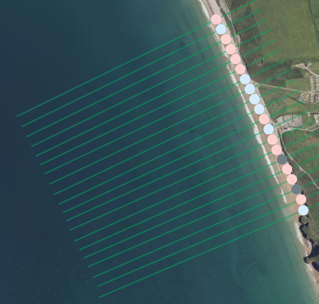
Mae proffiliau traeth yn fesuriadau 2 ddimensiwn o drychiad a phellter (cadwynedd) ar hyd llinell a bennwyd ymlaen llaw. Mae proffil y traeth yn cael ei fesur o gefn y traeth – megis morglawdd – ac yn ymestyn tua'r môr nes cyrraedd drychiad Distyll Cymedrig y Gorllanw (MLWS). Gelwir y pwynt cyfeirio hwn yn ddatwm fertigol. Mae cyfarwyddiadau manwl ar gyfer arolygon proffil yn adran y dogfennau.
Rydym yn cynnal dau fath o arolwg:
Gwaelodlin: Mae arolygon gwaelodlin yn cynnwys dosbarthiadau proffil dwysedd uchel; maent yn gostus ac yn llai aml ond yn darparu data manwl a chynhwysfawr iawn.
Interim: Mae arolygon interim yn defnyddio dosbarthiad proffil dwysedd isel; maent yn rhatach, yn cael eu cynnal yn amlach (bob dwy flynedd) ac yn rhoi mewnwelediad i dueddiadau tymor byr neu dymhorol.
Dros amser, mae proffiliau traethau’n cael eu hailadrodd fel y gellir cymharu newidiadau gan ddefnyddio graffiau.
Rydym yn defnyddio pedwar datwm fertigol, ynghyd â'r cadwynedd "cefn traeth", i gyfrifo'r ardal drawstoriadol (ADT).

Ardal Drawstoriadol (ADT)
Cross Sectional Area (CSA) is the area underneath the profile line from the back of the mobile beach to a specific vertical datum e.g. MLWS. Four examples of CSA are shown for the four datums below.

CSA is a single value to represent each profile. The time series chart displays a MLWN CSA from multiple survey dates.
This allows us to see how that CSA trends over time.


What can I learn from changing the datum?
If I use the datum selection in the menu I can choose;
MHWS - Mean High Water Spring is the average height of 'high waters of the spring tides'. Using this datum will show you changes above the intertidal area e.g. if a dune system is evolving.
MHWN - Mean High Water Neap is the average height of 'high waters of the neap tides'. Using this datum will show you changes to the top of the beach, e.g., this could inform you of changes closest to a sea wall.
MLWN - Mean Low Water Neap is the average height of the 'low waters of the neap tides'. A lot of historic data was collected to this datum and using this datum will provide data across most of the intertidal area.
MLWS - Mean Low Water Springs is the average height of 'low waters of the spring tides'. Using this datum will provide the most informed changes across the intertidal. The Wales Coastal Monitoring Centre have been surveying beaches to this datum since 2019. Data prior to 2019 may not exist for this datum. To unlock historic data, the MLWN datum can be selected.
Standard Deviation

In statistics, the Standard Deviation (SD) measures the amount of variation expected around a variable's mean. We use the SD values shown on the x-axis of this normal distribution plot to represent the variability of each profile's Cross Sectional Area.
The box and whisker graph (right) displays the CSA SD values from multiple surveys, which describes the distribution or natural variability of the profile. Values >2 or <-2 SD would be considered 'high variability'.

Statws Uned Arolwg
Mae Statws Uned Arolwg yn cyfrifo gwerth o'r arolwg diweddaraf a'i gymharu â'r holl arolygon blaenorol, gan roi syniad o gyflwr cyfredol amrywioldeb yr uned arolwg. Mae pob uned arolwg yn gallu cynnwys sawl proffil yn ofodol.
Mae Statws Uned Arolwg yn cyfrifo cyfartaledd gwerthoedd gwyriad safonol yr holl broffiliau yn yr arolwg diweddaraf. Er enghraifft, yn Uned Arolwg 8d2.10, cyfrifir y cyfartaledd ar gyfer GS ar draws 20 proffil. Mae'r raddfa yn "absoliwt," sy'n golygu bod gwerthoedd GS negyddol yn cael eu trawsnewid yn gadarnhaol i gyfrif am amrywioldeb ar hyd traeth. Mae hyn yn sicrhau bod traethau lle mae amrywioldeb uchel yn cael eu cynrychioli'n gywir. Mae amrywioldeb isel yn cyfateb i werthoedd o fewn un GS o'r cymedr (68% o'r canlyniadau), amrywioldeb cymedrol yw rhwng un a dau GS (95% o'r canlyniadau), ac amrywioldeb uchel yw mwy na dau GS (tua 5% o'r holl ganlyniadau).

Low Variability; 1 SD from the mean (68% of all results fall within this range)
Moderate Variability; between 1-2 SD from the mean (95% of all results fall within 0-2)
High Variability; is more than 2 SD from the mean (only 5% of all results will have an SD over 2)
Hydrodynamics
Wave power data demonstrates the short term antecedent hydrodynamic conditions. Long term seasonal wave events are also shown to provide context. The graphs are generated using E.U. Copernicus Marine Service Information.
Dates of named storms are from the Met Office UK Storm Centre.
Wave Power Equation


The return period of extreme wave height events has been calculated using extreme value analysis in python using the pyextremes package. The 'storm' threshold value was selected as the 95th percentile value (the top 5% of significant wave height values were classified as 'storm'). The peaks over threshold (POT) method was used, classifying any top 5% value within 16hrs of another to be one storm event to avoid capturing the same event multiple times. A return period of 1 year (365.2425 days) was used with a Weibull distribution in order to give the return period of each significant wave height 'storm' event. The return periods were then grouped by size of the event and the number of events in each year (from September to August to include an entire storm season) was counted e.g. a 2.568 return period value was grouped as a 1 in 1 year event, a 11.450 return period value is grouped as a 1 in 10 year event.
More details
What do the wave return periods mean?
Return periods are an estimate of the likelihood of an event to occur;
1 in 1/4 year (400% annual chance of occurrence)
1 in 1 year (100% annual chance of occurrence)
1 in 10 year (10% annual chance of occurrence)

Data Downloading
Ascii format data and reports are hosted by the National Network Regional Coastal Monitoring Programme (NNRCMP) and can be downloaded from their data download portal. Wales started collecting NNRCMP compliant data in 2019. For data prior to 2019 please use the contact us form
This video is an aid to downloading data from the NNRCMP portal
Data Use
-
CSA - It's important to clarify that the reported values represent theoretical Cross Section Area (CSA). This means the actual amount of mobile sediment on the beach might differ due to factors like underlying structures or local geology. However, theoretical CSA provides a valuable shorthand for comparing changes between profiles, especially when detailed information about the subsurface isn't available.
-
CSA - Profile height measurements have a vertical accuracy of ±30mm as detailed in our survey specification, available on our contractors page.
-
Timescales - Coastal systems exhibit natural variability across various timescales, including seasonal fluctuations and long-term cycles. Short datasets may not capture this full range of variability, potentially limiting assessments of climate change impacts.
-
Hydrodynamic Data Resolution and Limitations - This dataset provides offshore wave information on a grid with a resolution of approximately 1.5 kilometers. This means the data represents average conditions within each grid cell and may not reflect the specific wave conditions experienced at a particular point, especially near the coast. The data can only be taken as an indicator of trends.
-
Hydrodynamic Data Source - The wave data used here is hindcast reanalysis, which means it's a computer simulation of past wave conditions based on historical data. Find more information on quality here.
-
The data visualizations presented in this report are intended for preliminary assessment of coastal change. Due to inherent uncertainties in beach profile data, such as theoretical Cross Section Areas (CSA) and ±30mm vertical accuracy in height measurements, these visualisations should not be used in isolation for critical decision-making. As described above, all data can be downloaded for comprehensive analysis.